6.7 Navigation, Orientation
backDay 18: Climbing to Higher Ground
We climbed the hills today to get a better view of the island. It was exhausting, but worth it. From up there, we could see the steep cliffs along the western coast and the flat plains to the east.
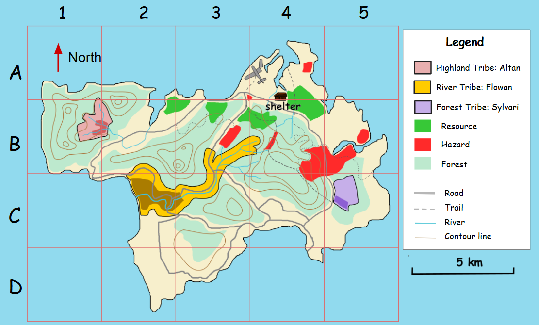
As I worked on the topographic map, I decided to make it more useful by adding a grid system. Each section of the map now has labels, like A1 or B3, so we can easily point out specific locations. This will help us give clear directions if we need to split up or communicate with others.
I also included a legend to explain the symbols we’ve been using. And luckily, when I first started sketching the map, I instinctively set north as the upward direction, which is how maps are usually drawn. This makes it much easier to align the map with the real world.
Lastly, I added contour lines to show changes in elevation. These will help us avoid dangerous climbs and plan the easiest routes. With these updates, the map is now our best tool for navigating the island safely and efficiently.

