P2W1: Navigation
backDay 10: Resource and hazard
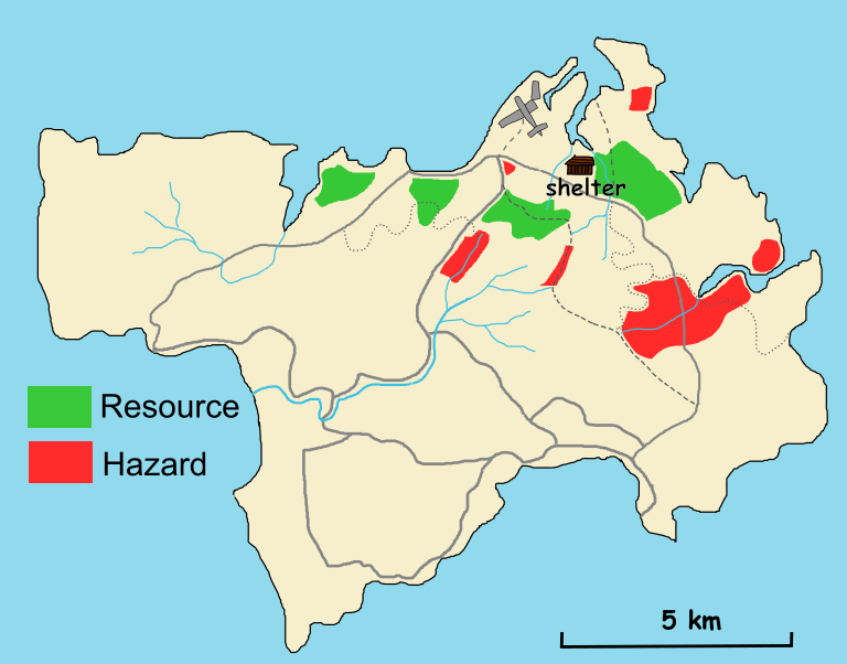
Food is becoming a serious problem. The small stash we saved from the wreckage is nearly gone, and it’s clear we need to find sustainable sources if we are going to survive. Today, we explored the island to map out where we can find edible fruits, roots, and other resources.
We found a grove of wild fruit trees near the edge of the forest. There’s also a cluster of plants with edible-looking roots growing near the riverbank. But not everything is safe. While foraging, we found a patch of thorny vines that scratched us up pretty badly, and we saw signs of wild animals, a trail of boar tracks leading into the forest.
By the river, we spotted fish in the clear water. That’s a great resource, but there were also crocodile tracks nearby, which turned it into a hazard. In the forest, we heard the calls of birds and found nests with eggs. The birds seem to stay in certain areas, and we marked those spots as food resources. Nothing is better than a good scrambled egg.
To make sense of it all, I created a resource and hazard map. The food sources, such as fruit trees, root patches, and fishing spots, the best drinking water sources are marked in green. Hazard zones, like the animal trails and thorny areas, are marked in red. The goal is simple: avoid the red zones, stick to the green, and make the most of what the island has to offer.
Tomorrow, we will start harvesting from the safest areas on the map. It’s not much, but it’s a plan. And right now, that’s enough to keep us going.

