P2W1: Navigation
backDay 7: Mapping Our Path
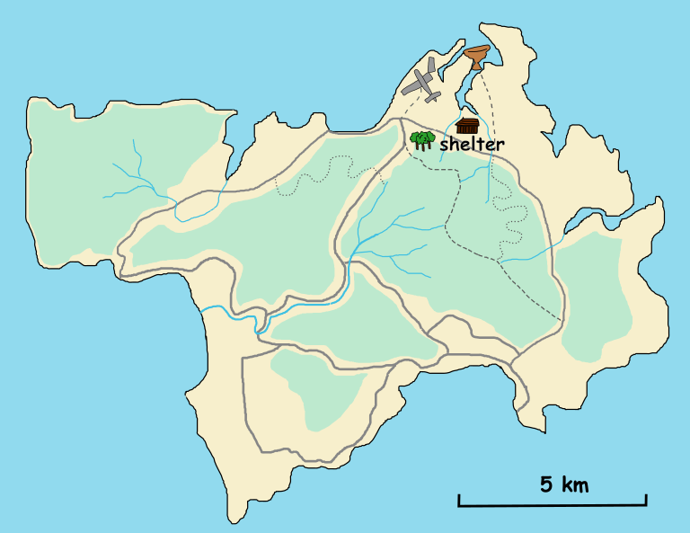
I finished the island’s basic map today. It is roughly 17 kilometers at its widest point and about 10 kilometers from north to south. Over the past week, we roamed all around the island, mapping not just the rivers and forests but also the trails. Everything important is now on the map.
Navigation details are essential. We need to know how to move through the island safely and efficiently. Around the river and the forest, we marked paths and trails. Some are narrow animal trails, while others seem to have been used by the local tribes. We also found shortcuts that lead to the freshwater spring and a flat area near the beach, which looks perfect for setting up a shelter.
The steep hills have been the hardest part to deal with. They are everywhere, and climbing them wastes too much energy unless it is absolutely necessary. To avoid them, I added dotted lines for trails showing easier paths around the hills.
The map is starting to feel like a lifeline. Every line and mark helps us feel a little less lost. From now on, this map will guide us through the challenges ahead.

